




Description
geoROAD
geoROAD.ai brings road and infrastructure asset management into the field. Part of the geoROAD.ai platform, the app gives inspectors, engineers and operations teams a live, map-based view of their network — assets, defects, devices and vehicles — with the tools to inspect, report and act on the spot.

MAP-BASED NETWORK VIEW
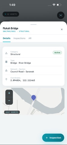
• See your organization's road network, assets and AI-detected defects on an interactive map.
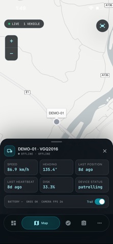
• Switch between defects and live fleet without leaving the map.

AI DEFECT DETECTION & VALIDATION
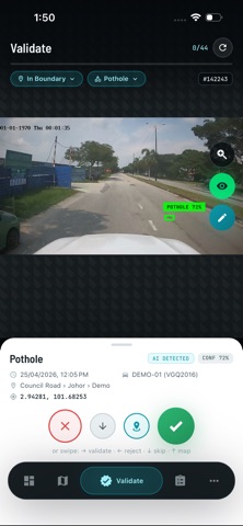
• Review road defects surfaced by geoROAD's AI vision system.
• Validate or reject findings directly from your phone.
• File manual defect reports with photos and GPS location.

INSPECTIONS & WORK ORDERS
• Capture field inspections with multi-photo uploads.
• View and manage the work orders assigned to you and your team.

LIVE VIEW — DEVICE CAMERAS
• Stream live camera feeds from ENViS edge devices in the field.

FLEET & DEVICE HEALTH
• Track your organization's vehicles live on the map — position, status (moving, idle or offline) and a 24-hour trail.
• Check per-device heartbeat and health at a glance.

DASHBOARD & REPORTS
• Monitor key metrics and generate reports on the go.

BUILT FOR TEAMS, IN FIVE LANGUAGES
• Fully localized in English, Spanish, Italian, Ukrainian and Greek.
• Real-time updates keep your whole team in sync.

ACCOUNT REQUIRED
geoROAD.ai is a companion to the geoROAD.ai platform and requires an account provided by your organization. Contact your administrator or visit georoad.ai to get started.
