Converdinate – Advanced Coordinate Conversion with Custom Projections
Converdinate is a professional-grade coordinate conversion tool designed for GIS specialists, surveyors, cartographers, and geosp
Converdinate – Advanced Coordinate Conversion with Custom Projections

Converdinate is a professional-grade coordinate conversion tool designed for GIS specialists, surveyors, cartographers, and geospatial professionals. Supporting a comprehensive range of predefined coordinate systems and allowing users to define custom projections and datums, Converdinate offers unparalleled flexibility and precision in geospatial data transformation.

Designed to replace traditional desktop-based conversion tools, Converdinate provides a lightweight and convenient solution for field survey work, allowing professionals to perform accurate conversions directly on their mobile devices without the need for a computer.


Key Features
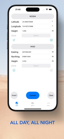
- Comprehensive  Conversion – Between multiple predefined projections and geographical datums, either from single input or data file.

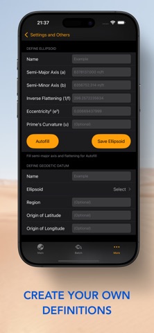
- Custom Definitions – Define and manage user-specific coordinate datums and projections to meet specialized project requirements. Supports Transverse Mercator, Mercator, Lambert Conformal Conic for projections.

- Adjustable Formats and Units – Adjustable precision and angular formats (DD, DM, DMS), as well as linear units (m / Int ft / US ft).

- Offline Functionality – Perform all conversions without requiring an internet connection, ideal for remote fieldwork.

- Others – Fetch current location, view location on map, angular format conversion tool...

Predefined Coordinate Systems and Datums – Includes support for:
WGS84 (Geographic, Cartesian, UTM (Auto zoning)),
US State Plane, Japan Plane Rectangular, KGD2002,
HK80, TWD97, SVY21,
NZCS2000, NZTM2000, OSGB36,
MGA2020, ITM, VN2000, ...


A Powerful Alternative to Desktop Tools for Field Professionals
Unlike standard coordinate converters, Converdinate not only provides extensive support for predefined systems but also allows users to define custom projections and datums, ensuring maximum flexibility for specialized applications. With its mobile-first approach, it serves as an essential tool for field surveyors and GIS professionals who need quick, reliable, and precise coordinate transformations without relying on a computer.

Download Converdinate today and streamline your geospatial workflows—anytime, anywhere.