

Description
View live flood camera images from council disaster dashboards across Queensland — all in one app
View live flood camera images from council disaster dashboards across Queensland — all in one app.
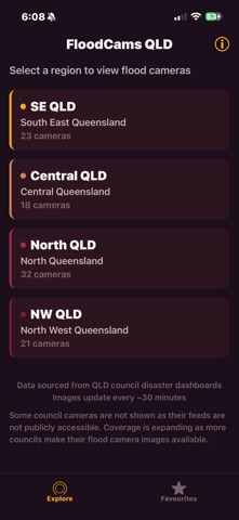
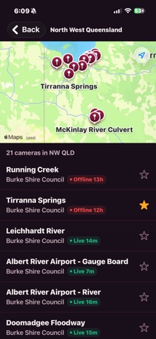
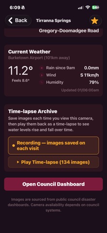
FloodCamsQLD pulls camera feeds from 12 councils covering regions from the Gulf Country to SEQ. Browse by region on the map, save your most-used cameras as favourites, and check local weather conditions at each site.
Turn on recording for any camera and the app saves a snapshot each time you visit. Play those images back as a time-lapse to see water levels rise and fall over hours or days.
Features:
• 90+ flood cameras from 12 Queensland councils
• Browse cameras by region with map view
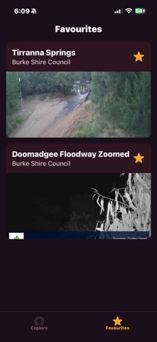
• Favourite cameras for quick access
• Time-lapse archive — record and play back water level changes
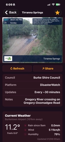
• Weather conditions at each camera location
• Share camera images directly from the app
• Pull to refresh for the latest image
Camera images are sourced from public council disaster dashboards. Camera availability depends on council systems and may vary during outages.
