Your day on the beach in Jersey — in one glance.

Jersey Beach App answers the question every islander asks: which beach is best
right now? Every bay faces a different way, so the same wind that ruins St
Ouen's can leave Grouville glassy. We read the live wind and rank all 18
beaches by shelter — calmest at the top, blown-out at the bottom.

IS THE CAUSEWAY STILL WALKABLE?
• Elizabeth Castle, St Aubin's Fort, Corbière and the Havre des Pas pool
• Whether the crossing is open right now, and the minute it closes
• Thresholds are Ports of Jersey's own survey figures, never our estimates
• Marina gates too — they work the other way round
• If the tide data looks wrong it says so, rather than guessing

RAIN RADAR
• The last two hours of rain over Jersey and the Channel, playing as a loop
• See a shower coming off the Atlantic while it is still out there

TODAY AT A GLANCE
• Temperature and feels-like, UV index with sun-safety advice
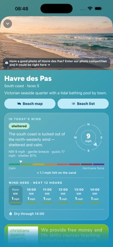
• Wind, gusts and direction on a compass
• Sea temperature and swell
• Sunrise, sunset, and the next 12 hours hour by hour

THE BEST BEACH, RIGHT NOW
• All 18 of Jersey's beaches ranked live by wind shelter
• How much wind you will actually feel on the sand
• Re-rank for what you are doing: sunbathing, a walk, the dog, a surf, a coffee
• Lifeguard cover, dog rules that change with the season and the hour,
  parking, how hard the walk down is, and the rips worth knowing about

BEST TIMES TO GO
• The best windows in the next 24 hours for a swim or a dog walk
• Scored on temperature, wind, rain, UV and the tide — each with its reason

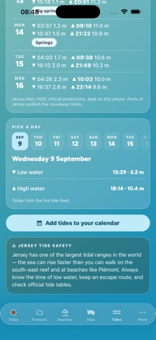
TIDES, MOON AND SPRING TIDES
• A 24-hour tide curve for St Helier, next high and low water, rising or falling
• Tonight's moon phase, and the spring–neap outlook
• When the fortnight's biggest tides arrive, and with them the lowest water
  for fishing, rock pools and reef walks

BATHING WATER QUALITY
• The Government of Jersey's weekly bacteria samples, shown unaltered
• Always with the date the sample was taken
• Nothing shown for the bays they do not sample — we will not borrow a
  neighbour's reading and call it yours

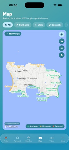
THE ISLAND, MAPPED
• Every bay, wind shelter at a glance, and live wind arrows across the island
• Public toilets, the nearest bus stops, and which traders are out today
• Tiles are cached, so the map still works down on the sand with no signal

A NUDGE WORTH HAVING
• An optional morning heads-up on genuinely good beach days
• Warnings for big spring tides and strong winds. Nothing else, ever.

ON THE SAND
• Which food trucks, beach cafes and shops are open today, and their specials

Hour-by-hour forecasts from the Met Office 2 km model, served via Open-Meteo.
Not endorsed by or affiliated with the Met Office.

This app is a guide, not a safety service. Always follow lifeguard flags,
signage and the official tide tables before entering the water or crossing a
causeway.

No tracking, no ad networks, no account needed. Free, made in Jersey, for the
people of Jersey.

Built by Pinkie & the Brain — bespoke web and mobile apps, made in Jersey.