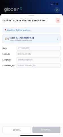
My Globeir is a comprehensive field service and GIS mobile application designed for field workers, surveyors, and customer-facing teams
My Globeir is a comprehensive field service and GIS mobile application designed for field workers, surveyors, and customer-facing teams.

KEY FEATURES:

• Field Visit Tracking
  Record customer visits with automatic location capture and time stamps during work hours (7:30 AM - 7:30 PM, Monday-Saturday).

• Interactive Maps
  Powered by Mapbox technology — view assigned locations, get turn-by-turn navigation, and see your field activity on detailed maps.

• Background Location Logging
  Automatically tracks your field routes during work hours to maintain accurate visit records — no manual logging required.

• Photo Capture & Documentation
  Capture photos and documents directly within the app for field reports and customer records.

• OCR Text Recognition
  Extract text from documents and signage using built-in ML-powered text recognition.

• Offline Capability
  Continue working in low-connectivity areas — your data syncs automatically when back online.

• Multi-tenant Support
  Single app that connects to your organization's specific backend — secure and configurable.

PRIVACY & SECURITY:
We take privacy seriously. Location tracking is restricted to defined work hours, and all data is encrypted in transit and at rest. View our privacy policy at [your URL].

Designed for field service organizations, sales teams, surveyors, and any business that needs reliable field activity tracking with mapping intelligence.