LensTrails is a private photography journal and intelligent shoot planner for photographers who collect places, ideas and experiences, not just pictures
LensTrails is a private photography journal and intelligent shoot planner for photographers who collect places, ideas and experiences, not just pictures.

Try LensTrails Pro free for one month, with no registration. Viewpoints are available through the separate LensTrails Complete subscription. After the trial, an active subscription is required.

BUILD YOUR PHOTOGRAPHY JOURNAL
Save locations from the map, Google Maps, a new photo or a geolocated camera-roll image. Keep:
• Photos, notes and creative ideas
• Tags, ratings and location types
• Preferred month and time of day
• Shooting direction
• Address, coordinates, elevation and distance
• Visit and return-planning details

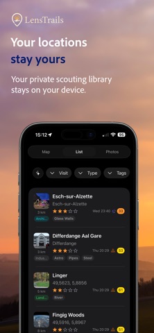
Browse your journal on a map, in a searchable list or as a photo grid. Filter by name, notes, tags, type, rating, distance or preferred shooting time.

DISCOVER VIEWPOINTS
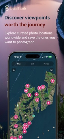
LensTrails introduces Viewpoints, a curated worldwide catalog of promising photography locations.
Explore Viewpoints on the map, open a location to see its available photos, notes, tags, address and photographic context, then evaluate its conditions using LensTrails planning tools.
Import the locations that interest you into your private journal and add your own photos, notes, tags, rating, shooting direction and preferred timing.
Viewpoints help you discover places. LensTrails helps you plan the photograph.
Your personal locations remain private and are never published, crowdsourced or added to the public catalog.

GET SMART SHOOT SUGGESTIONS
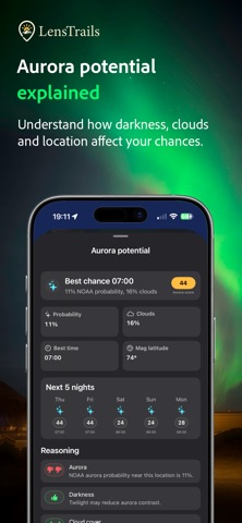
LensTrails evaluates saved locations using their character, tags, preferred timing, shooting direction, weather, clouds, fog, sunrise and sunset quality, sun position, moonlight, night-sky conditions, aurora potential, light pollution and tides where relevant.
Each suggestion provides a score, recommended time window, direction to face and an explanation of why the conditions may work. Long-term suggestions identify useful months and times to return.

PLAN WEATHER, LIGHT AND SKY
See current conditions and a five-day forecast, including temperature, rain, wind, humidity, visibility and cloud layers. A 24-hour cloud graph helps reveal changing conditions.
Plan daylight, golden hour, blue hour, sunrise, sunset, moon, stars, Milky Way and aurora photography. Use map overlays and Sky Path camera previews to understand how light and sky objects move around a scene.

FIND DARKER SKIES
Explore light pollution on the map and understand how nearby light sources may affect night photography.
PLAN COASTAL PHOTOGRAPHY
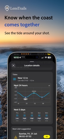
See five-day tide forecasts and detailed tide curves. LensTrails can consider tides when suggesting shoots involving beaches, rocks, reflections, access and moving water.

MADE FOR THE FIELD
Search by address or place, check elevation, navigate with your preferred mapping app, share locations and receive reminders. Export your journal as GPX or CSV.
Your locations remain private on your iPhone, with optional private iCloud sync between Apple devices.
LensTrails is made for landscape, cityscape, seascape, travel, drone, street, wildlife and outdoor photographers.

Terms of Use: https://lenstrails.jerome.photo/eula.html
Privacy Policy: https://lenstrails.jerome.photo/privacy.html